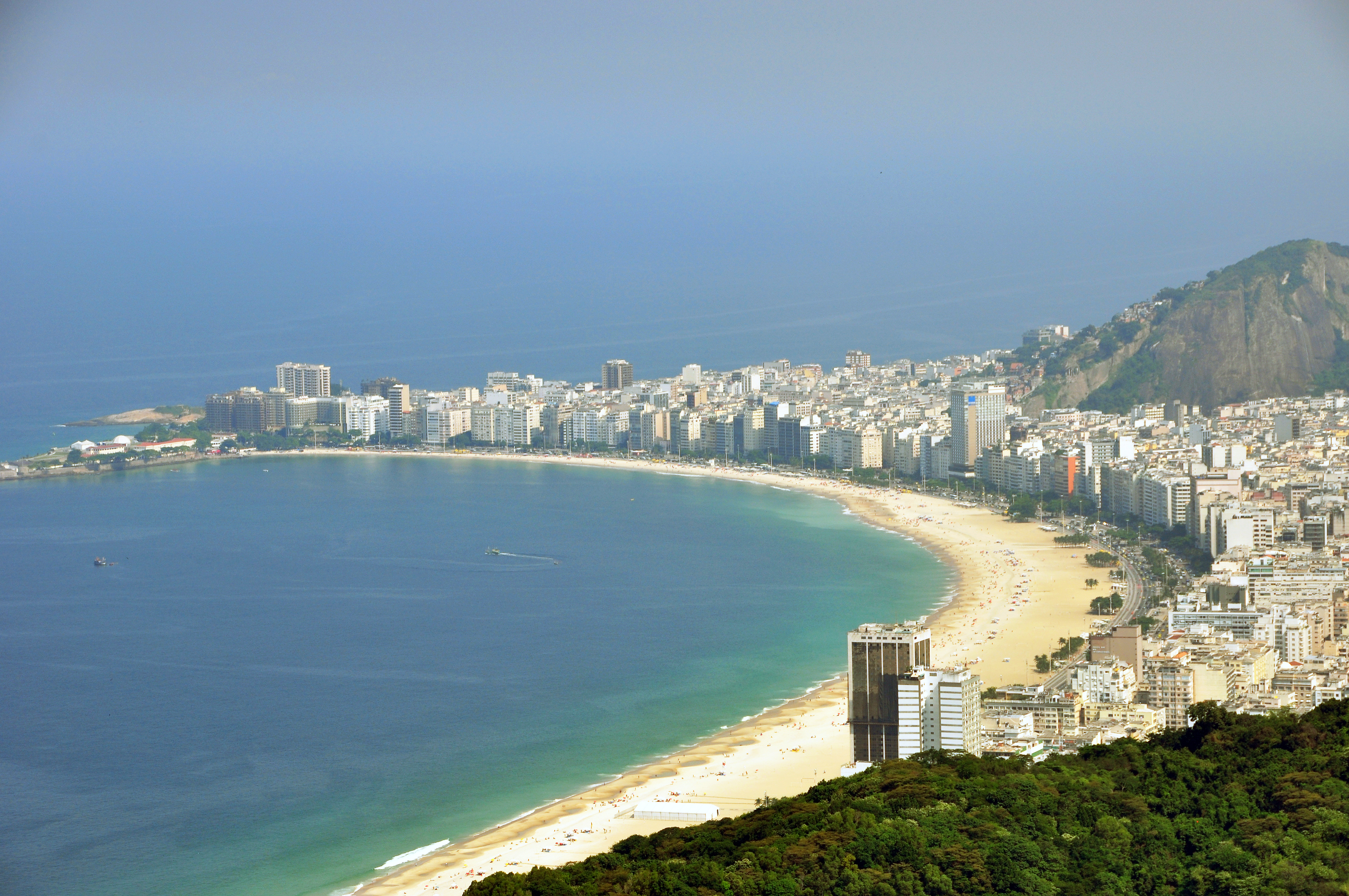
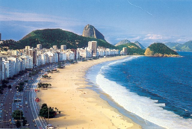
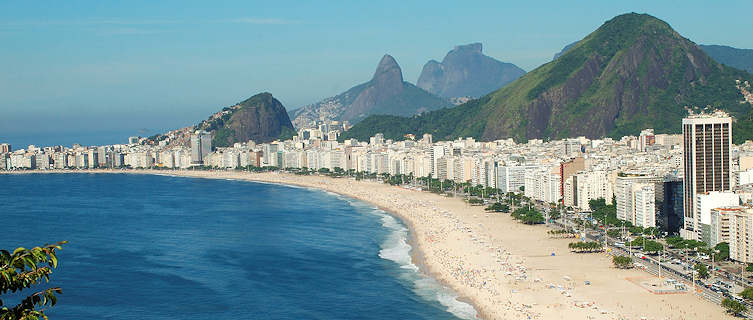
Copacabana Beach, Rio de Janeiro
Copacabana is perhaps the most famous neighborhood
of the city of Rio de Janeiro, Brazil. Formerly called Sacopenapã, owes its
current name to a copy of the Virgin of Copacabana, whose shrine is located in Copacabana,
Bolivia
The beach is quite large, crescent-shaped, with a distance of approximately three miles from end to end. Although I must say that Copacabana actually has a little over three miles. The rest of the beach, although it is actually the same, is called Leme, which is also the name of another neighborhood of Rio.
Copacabana is also a populous neighborhood of Rio
de Janeiro and one of those most densely populated in the world. It is said
that if everyone in the neighborhood of Copacabana leave while the beach, there
would be room for everyone.
Kiosks or on Copacabana beach bars. You can
also see the typical cobblestone promenade.
The beautiful and historic Hotel Copacabana Palace in Rio de Janeiro.
<Extension>
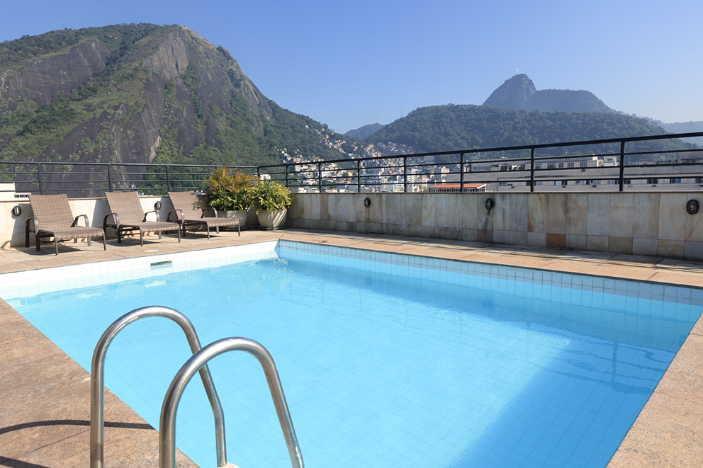
The neighborhood is full of hotels, restaurants, bars, clubs and all kinds of leisure and services, as it is possibly the most popular place in town, which receives more tourists throughout the year.
<Extension>
The neighborhood is full of hotels, restaurants, bars, clubs and all kinds of leisure and services, as it is possibly the most popular place in town, which receives more tourists throughout the year.
At the end of the beach is the Copacabana Fort, a fort established in early twentieth century to improve the defense of the city and Guanabara Bay. Now tourist attraction.
Are typical of Copacabana paved boardwalk and beach bars on the beach.
.
Located in the South Zone of the city, Copacabana beach has a crescent shape and is nicknamed Princess of the Sea because of its aura in the 30s, 40s and 50s bohemian neighborhood, glamor and wealth, Copacabana gave rise to numerous events and artistic movements, becoming tourist reference of Brazil.
Located in the South Zone of the city, Copacabana beach has a crescent shape and is nicknamed Princess of the Sea because of its aura in the 30s, 40s and 50s bohemian neighborhood, glamor and wealth, Copacabana gave rise to numerous events and artistic movements, becoming tourist reference of Brazil.
The neighborhood has plenty of restaurants,
cinemas, banks, synagogues (traditionally shelters the carioca Jewish
community), local shopping and theaters.
From the 1960s, the growing fame attracted more inhabitants than the area can receive comfortably and Copacabana suffered with real estate speculation to fill with high properties with tiny shops. The place became a Brazilian microcosm, uniting families of different classes in that tight piece of land between the sea and mountains.
From the 1960s, the growing fame attracted more inhabitants than the area can receive comfortably and Copacabana suffered with real estate speculation to fill with high properties with tiny shops. The place became a Brazilian microcosm, uniting families of different classes in that tight piece of land between the sea and mountains.
Copacabana is comprised of 109 streets in which more than 147,000 people
from all walks of live, which realizes the high population density in the area.
With 358.51 inhabitants per hectare, is one of three districts with greater
density River, just below Rocinha and

Copacabana is included in the Planning Area 2 and
share Administrative Region V (Copacabana) in Leme neighborhood.
It borders the neighborhoods of Ipanema, Lagoa, Humaitá, Botafogo and Leme.
A nose is "hovering" in the streets of Copacabana.
The neighborhood of Copacabana is bounded by:
Northeast: Avenida Princesa Isabel
east: Avenida Atlântica and the Atlantic Ocean
south: Fort Copacabana
west: the mountains (hills) of Leme, São João, Two Kids and Cantagalo.
It has a land area of 410.09 hectares.2 and 73.90% of its areas are urbanized and / or alteradas.3
sarai de jesus cuellar heifer ← Their ocean beaches stretch for 3.2 kilometers along the shores of Atlántico4 ocean with an index of water quality of 92% (on average, taking three benchmarks) .5

History
The Indians who occupied the area now includes Copacabana, Ipanema, Leblon and Lagoa Rodrigo de Freitas was called Socopenapã, resulting da contraction of the words of Tupi origin SOCO-APE-Nupa, with which the Indians called it the "path souks ", a bird that lived in the area. Successive historical references eventually turn by mistake in Sacopenapã.6
Copacabana was a sandy desert when, in the seventeenth century, fishermen erected a chapel on the south end of the beach and introduced in it a reproduction of an image of Nossa Senhora de Copacabana Bolivian origin. Brought to Brazil by merchants of Peruvian silver, the picture ended up naming the beach and neighborhood. Later, with the construction of Fort Copacabana, historic chapel was demolida.7
Avenida Atlântica in the 1910s.
Current slope of Leme was the first land access to Copacabana. At the top of the hill was erected Fort Leme, in 1722, whose arches remain in place. With the emergence of the Ladeira do Barroso, in 1855, residents of the city, including the Emperor Dom Pedro II, were true trips to those areas remotas.6

By 1858, the news that two huge white whales lying on the sands of Copacabana
aroused the curiosity of the cariocas, which began aa attract the attention of
the inhabitants of the city to the playa.7
The urbanization of the region began with the opening of the Old Tunnel and the arrival of the train line line Companhia Ferro-Carril Botanical Garden, 1892. Two real estate companies began to lotear the land of the neighborhood and, in 1917, Copacabana already had 45 streets, an avenue, four seats and two tunnels. The Avenida Atlântica was opened in 1906 by the prefect Francisco Pereira Passos and widened in 1919, during the administration of Paulo Frontin.7
Tribute to the Revolt of the Fort.
The district was consolidated in the first two decad.
Population
Typical Copacabana apartment building.
The district has 147,021 permanent inhabitants of whom 61,515 are men and 85,506 women.1 The sex ratio is 71.92 Copacabana men per hundred women, which is the lowest rate of masculinity in terms of neighborhoods in Rio de Janeiro .
It has a population density of 358.51 people per hectare. There are 61,807 households (found in the third position among Rio neighborhoods with more homes), of which 18,416 have one inhabitant, 19,589 are inhabited by two people and 11,780 with three people.1
Life expectancy at birth is 77.78 years and the adult literacy rate
is 98.48% .1
It has ten municipal schools with a total of 4,600 alumnos.9
It has a Human Development Index (HDI) 0956.10 Same as Japan and Luxemburgo.11
Copacabana is the main area of concentration of people in the streets (homeless) South Zone. 29% of people living in the open in Copacabana are women, and the number of children and adolescents is higher than the city average, reaching 21.2%. Most (27.6%) ended up living on the street by family conflicts, while 25.9% claimed unemployment and 5.3% did so by using drogas.12
According to 2004 data, the favelas located in Copacabana occupied 159.955,5
square meters, implying an increase of 3.091,4 square meters since 1999.13.
In 2006 337 cases of dengue were reported, it became the tenth
district of Rio with more infected, although no casualties fatales.14
Featured Sites
In the diagnostic phase of the Strategic Plan Río15 a perception survey of the population, among other data, can identify areas and emblematic buildings of the neighborhood in the opinion of its inhabitants was made:
The waters of Copacabana.
Historical Museum of the Army and Fort Copacabana
Urban landscape Set of Avenida Atlântica
Copacabana Palace Hotel
building Guarujá
building Guahy
Villiot house
National Institute of Social Service
It also highlights the numerous waterfront hotels like the Pestana Rio Atlantica, JW Marriott, California Othon Clasic, Orla Copacabana, Astoria Palace, Rio International, among others.
Economy

The neighborhood has in tourism one of its main income. During 2004,
the largest city hotel occupancy was recorded in the area of Copacabana and
Leme, between February and December, with 67.85% of hosted in Rio de Janeiro.
However, Barra da Tijuca neighborhood São Conrado and Copacabana and Leme
outperformed in January of that same year.16
Transport
See also: Rio de Janeiro Metro
Numerous bus lines pass through Copacabana, mostly in north-south direction by Barata Ribeiro and northbound on Nossa Senhora de Copacabana and Avenida Atlântica.
Cantagalo Station.
Transport
See also: Rio de Janeiro Metro
Numerous bus lines pass through Copacabana, mostly in north-south direction by Barata Ribeiro and northbound on Nossa Senhora de Copacabana and Avenida Atlântica.
Cantagalo Station.
The Metro (subway) is the most agile form of communication with the center
and north of the city (is planned to open in late 2009 of a station in Ipanema,
as a projection of an extension to the west). Line 1 of the subway has three
stations in Copacabana:
Cantagalo (with a daily flow of approximately 35,000
passengers) was to build the Osório / Ipanema station the end of the tour,
south of Copacabana.
Siqueira Campos (60 000 passengers per day), in the center of the neighborhood, has connections with the Metrô na area (which reaches Leblon) and the bus Expresso Barra (Barra da Tijuca).
Cardeal Arco Verde (23,000 passengers per day) is on the northern end of Copacabana. From Cantagalo to Cinelândia Station in the center, subway takes approximately 14 minutes and 50 segundos.17
No hay comentarios:
Publicar un comentario